

Opportunities and Resources
Opportunities and Resources
Targeted inspiration for planning adventure travel


This essay was inspired by a talk I gave at the Howling Micro-Rally hosted by Wildwood Open Lands Foundation this June. While the examples are focused on Nevada and the Great Basin, I hope they can be extrapolated to your region.
When I started this newsletter I imagined it would be a place to share the background research that goes into planning a trip. So far I have been writing about topics inspired by my trips. This month’s installment is based on hopeful outlook that we have incredible resources in our public lands out our backdoor that are managed by a wide variety of government entities. These agencies provide a variety of online and in-print resources that can only make trip planning better.
We are living in a golden age of adventure travel. We have access to high quality clothing and equipment as well as the expertise backed by the willingness to share by incredibly talented and motivated people. There is a widening conversation about the benefits of outdoor recreation that includes government officials, medical and health professionals, as well as the general public. The how, why, and who of adventure travel are answered. My favorite question is, Where?
I am so lucky to live in Nevada where my passion is adventure travel. This began for me 10 years ago wondering where I could go by bicycle if I followed the next dirt road. For the first couple of years the dirt roads kept linking up and little planning was necessary. Some basic facts about Nevada, it is the 7th largest, 8th ranking in lowest population density, the most mountainous state (300+ mountain ranges with the most number of peaks over 10k feet, lies mostly within the Great Basin, and is characterized by high cold desert. Nevada has the highest percentage of public land. Because such a high percentage of this public land has been explored for minerals and grazing there is an amazing network of dirt roads providing absolute solitude in incredibly diverse landscapes.

From connecting dirt roads I could see out my back door, I graduated to the Delorme Nevada Gazetteer and Google Maps Satellite View. Eventually I started planning, mapping, and following routes with GPS tracks using the free tools provided by STRAVA or Garmin. But I wasn’t making the connection to the land managers. I wasn’t making the distinction between county, state, Bureau of Land Management, Forest Service, or tribal lands. I wasn’t certain when public roads crossed private land unless it was posted. Similarly I wasn’t aware of wilderness boundaries.
For the most part I wasn’t making mistakes such as riding in wilderness or venturing onto closed or private property. But what I was missing out on was using the resources provided by land managers to create amazing adventures. It is very timely that Adventure Cyclist Magazine, the 6x a year publication of Adventure Cycling, published an article in their July/Aug 2023 edition, From Boulder to Bullfrog, Navigating Utah’s Public Lands, by Greg M Peters. In the sidebar Peters included a section, America’s Public Lands, and included a description of the BLM, National Forests, National Parks, National Monuments, Recreation Areas, Wilderness Areas, and Additional Links with local sources. Peters showed how this list was relevant to his trip planning.
I am inspired by the print and personal outreach in National Parks visitor centers. Often there is a newsletter with a section, “If you only have a couple hours…, one day…, two days…,” giving you a highlights tour. I have followed these suggestions in Death Valley and Joshua Tree with great results. I will also ask the rangers for their favorites. I apply this in all my visitor center visits.
The Department of the Interior is the largest federal land manager. They oversee the Bureau of Land Management (BLM), Bureau of Reclamation, National Park Service, US Fish and Wildlife Service (USFWS), and the US Geological Service (USGS). I mention just these because the put recreation on the forefront of their mission. I included the USGS because they do the mapping I rely on the most and places of scientific study also excite the adventure nerd in me.
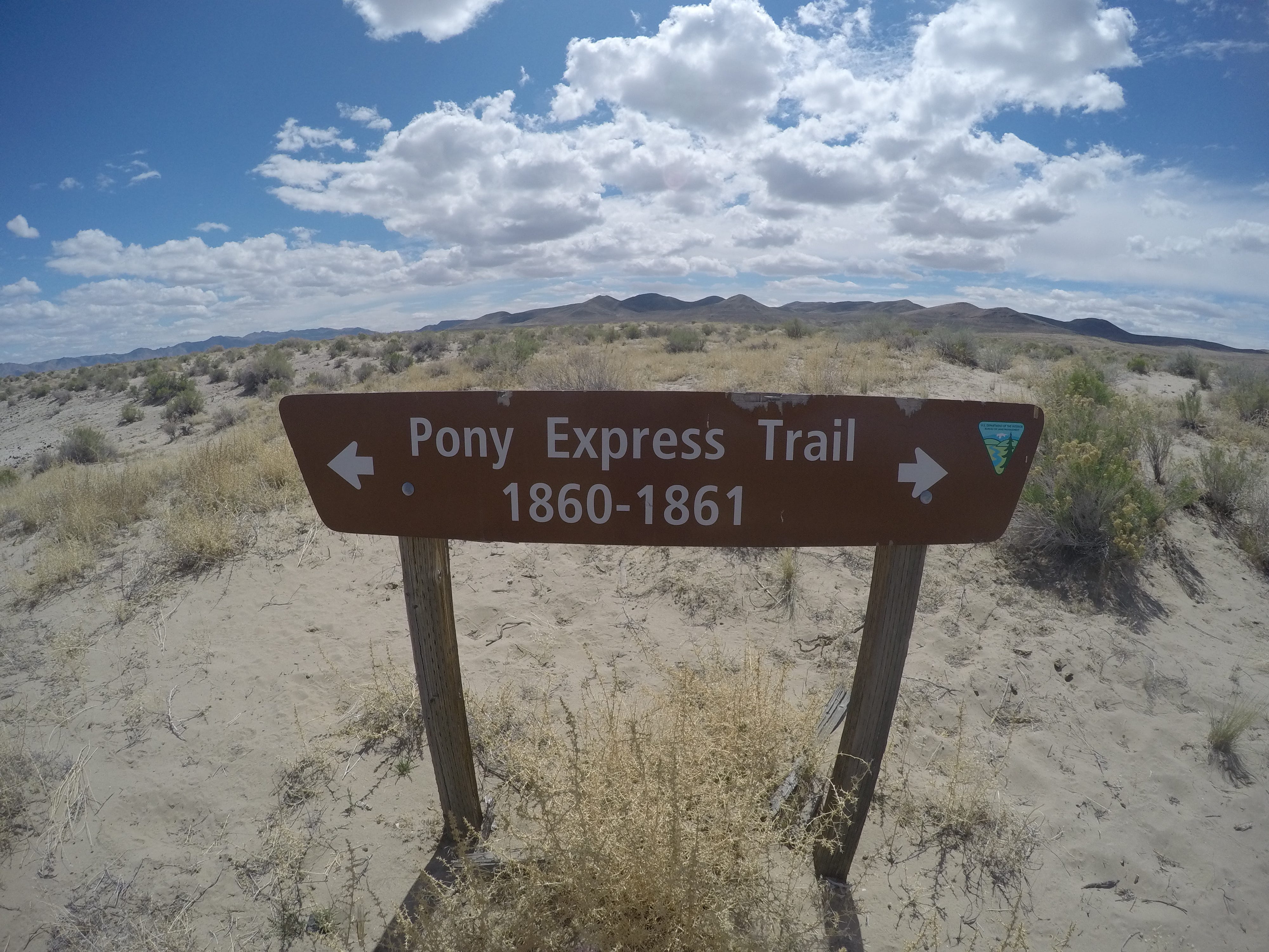
Once I start going down the rabbit hole of clicking around these agencies websites I was pleased to find information on the familiar, but then find new places to visit. For example when starting at USFWS, I honed in on the Stillwater National Wildlife Refuge (NWR), outside of Fallon Nevada. I really enjoy gravel riding in the refuge and beyond. The interpretive trails and observatories fulfill my inner nerd. From Stillwater NWR, there is great access to the Pony Express Trail, wilderness study areas, Sand Mountain Recreation Area, and Grimes Point/Hidden Cave Archaeological Site, just to mention a few spots managed on public lands by agencies under the Department of the Interior.
In the remote northwest corner of Nevada is the Sheldon NWR. I have visited the southern boundary from the Black Rock Desert - High Rock Canyon Emigrant Trail National Conservation Area. I realized I was entering a uniquely managed area when I saw signs restricting camping to designated sites. It is changes like this that presses the importance of knowing where you are and the restrictions you might have. To return to the Sheldon I would need to map out these campsites and plan on clear dark nights as the Sheldon is a neighbor to the Massacre Rim Dark Sky Sanctuary.
When I searched the FWS website for NWR’s, nine were listed. Of course I want to visit them all. All in good time. I just visited Ruby Lake this summer for the first time. I have driven past Pahranagat NWR on my way to Gooseberry Mesa, UT. There are camping, fishing, and biking opportunities in the area. It is adjacent to the Desert National Wildlife Refuge and near the Basin and Range National Monument. Clearly there is enough to fill a week’s adventure centered from this NWR alone.
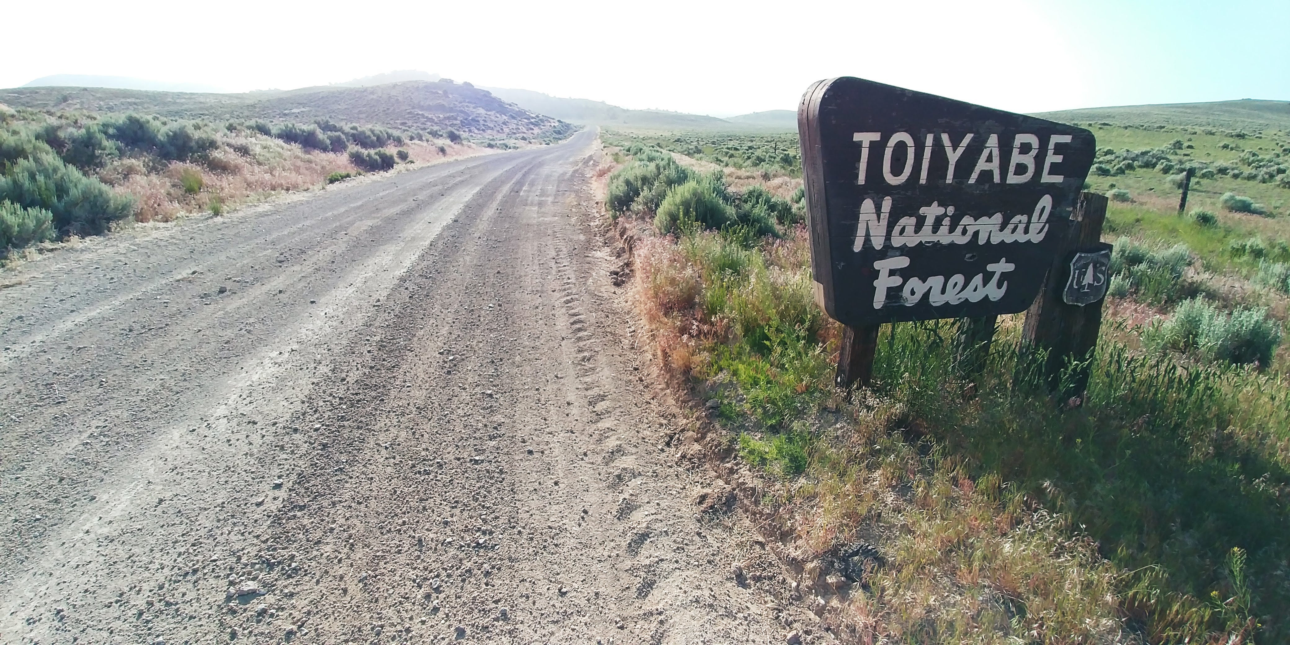
The US Department of Agriculture’s Forest Service should not be outdone by the BLM. In many parts of the country the Forest Service is the largest public land manager. The Forest Service manages the Humboldt-Toiyabe National Forest, 6.3 million acres in Nevada and Northern California, the largest National Forest in the lower 48. I am about to leave on a bikefishing trip through Paradise Valley and a portion of the Humboldt-Toiyabe Santa Rosa Ranger District. Their recommendation for fishing is the Lye Creek Campground. That was easy information to get. While the Humboldt-Toiyabe National Forest is spread throughout the state, don’t overlook the Inyo National Forest in the White Mountains.
Beyond federal land manager resources there are parallel state departments with a recreation emphasis. While I am using Nevada as an example I hope these agencies are repeated in some form from state to state. Nevada has a Department of Conservation and Natural Resources and under that the Division of Outdoor Recreation. The resource I use the most under the DCNR is the Division of State Parks. There are 29 State Parks that represent the best of Nevada’s state lands. A new resource developed and managed in collaboration with Department of Conservation and Natural Resources, the Division of Outdoor Recreation, Nevada State Parks, Off Road Nevada, and Great Basin Institute, is the Nevada Trail Finder. I used this resource on my last visit to Ely and it provided a jumping off point for a week of travel. The Trail Finder Tool has the greatest diversity in recreational opportunities.
Another state resource is the Nevada Department of Wildlife (NDOW). While the organization is best known for hunting, fishing, and boating regulations and licensing, at the same time it provides planning tools for wildlife viewing. NDOW’s latest marketing to get you outside is based on the health benefits of 120 minutes outside a week, or just Take 17 minutes a day. Their program has three resources, digital tools, outdoor activities, and health benefit sources.
A favorite state based resource is Travel Nevada. Like the Trail Finder, Travel Nevada is the most diverse resource for adventure travel in Nevada. Not only can you find the best wild places the state has to offer but you also find the best festivals, restaurants, and entertainment. Travel Nevada is the most timely and up to date resource for Nevada tourism. Their articles always make their way into my research from the burgers at Middlegate Station to the Basque Festival in Elko.
Non-profits also provide a great resource in planning an adventure. Friends Groups; Friends of Red Rock Canyon, Friends of Nevada Wilderness, and Friends of Black Rock-High Rock are three that I use. The Nature Conservancy promotes visiting their projects. Dangerous Roads became a source for my highest roads in Nevada project. All of these organizations, government and non-government, have tools to get you out there. They are banking on your inspiration and conversion to stewardship. While I don’t want this article to read like a how-to-do web based research, my hope is to point out a variety of planning resources designed to make your trips richer.
Online Resources:
August in Review:
The month started with a bikerafting overnight on Stampede Reservoir with Doug Artman. Then I was at the Black Rock Desert for a series of rides for the Perseids Meteor Shower Campout sponsored by the Friends of Black Rock High Rock. I finished the month volunteering with the Earth Guardians at the Burning Man event. I led several sunrise and sunset tours talking about the landscape beyond Black Rock City. This was my first experience at Burning Man. I biked in from the town of Gerlach. You have heard of Burners without Motors? Ha!
Upcoming Calendar:
Sept. 6-8 Bikefishing Paradise Valley with Doug Artman
Sept. 16-17 Rides with Friends #6 Massacre Ranch Dark Skies Overnight
Sept. 22-24 Lava Beds - Seven Troughs 3-Day Loop
Oct. 14-15 Rides with Friends #7 Black Rock Hot Springs and Micro-Playas Overnight
Oct. 22-? Great Basin Crisscross with Doug Artman
Thank you for supporting my story telling. I hope you got something from this month’s newsletter. Next month I will be reviewing Mapping and Imagination in the Great Basin : A Cartographic History by Richard V. Francaviglia.
I visited Sheldon NWR in June, camping at Gooch Springs. I have decided the NWR system are true gems of Public Lands…solitude, beauty, relatively unknown when compared to Nat’l Parks and designated Wilderness Areas.
Our tax dollars hard at work. I have had a great time exploring OHV areas by bicycle, though it has payed to go during the week...