


We Were Not First, Part 2
Coyote Writing

If interest in hot springs is the number one question for adventure travel in Nevada I think petroglyphs are a close second. My introduction to petroglyphs came from working with an archeologist in trail work on Reno’s Peavine Mountain. Understandably our our local Paiute tribes were concerned that trails would be built over or too close to sensitive indigenous sites. The archeologist offered up, if you are wondering where to find petroglyphs then imagine yourself a young First Peoples hunter, waiting out a storm from an advantage to see deer or other prey pass by. What a simple explanation, but something I have always kept in the back of my mind when traveling through the Northern Nevada landscape.


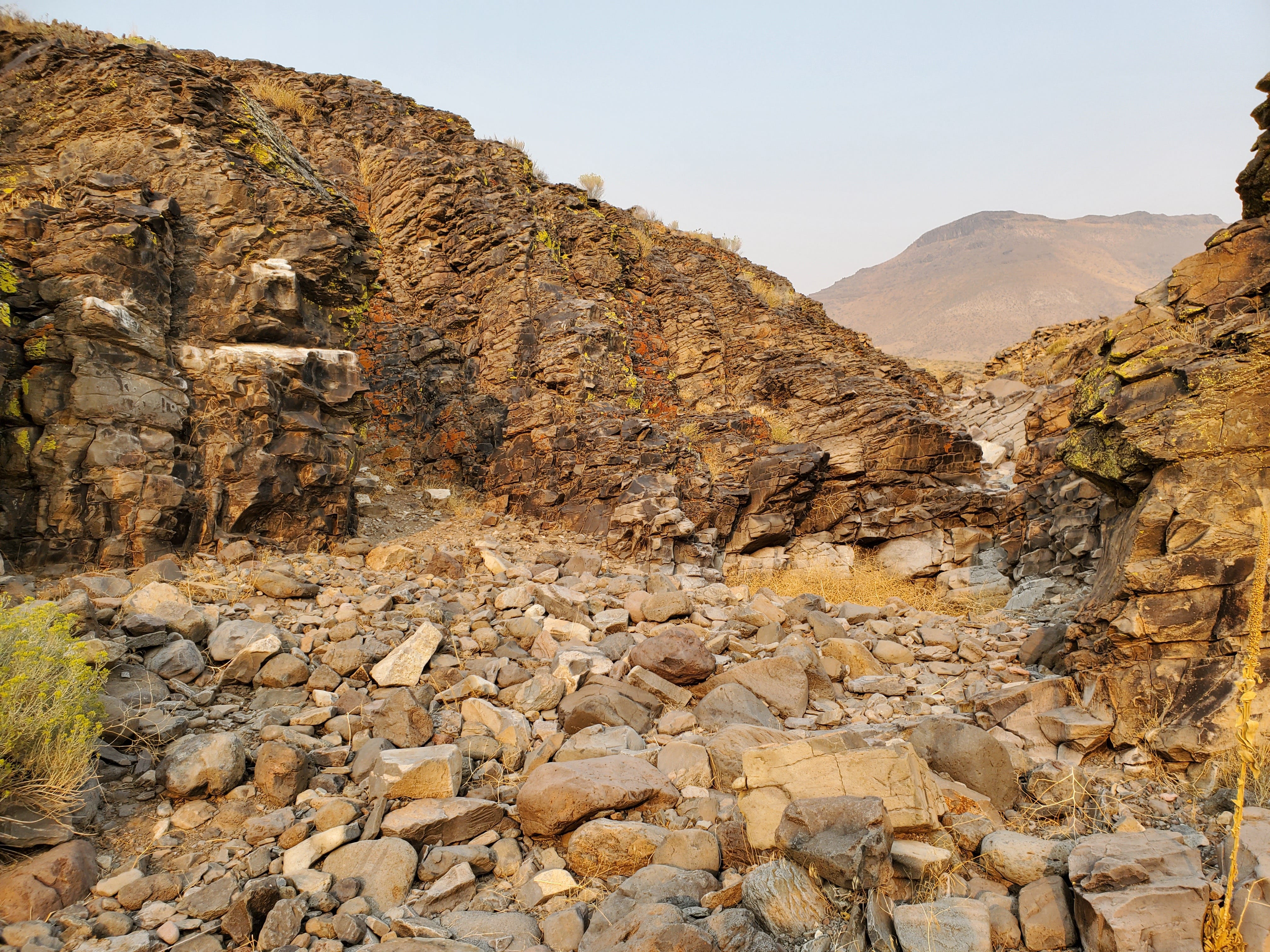
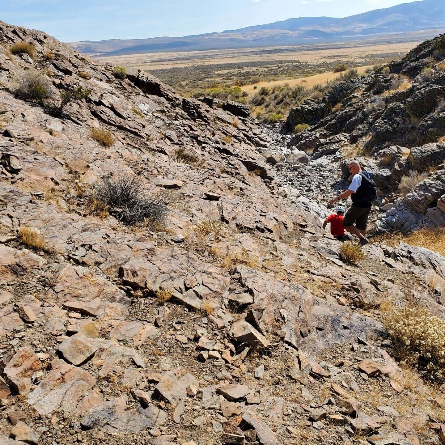
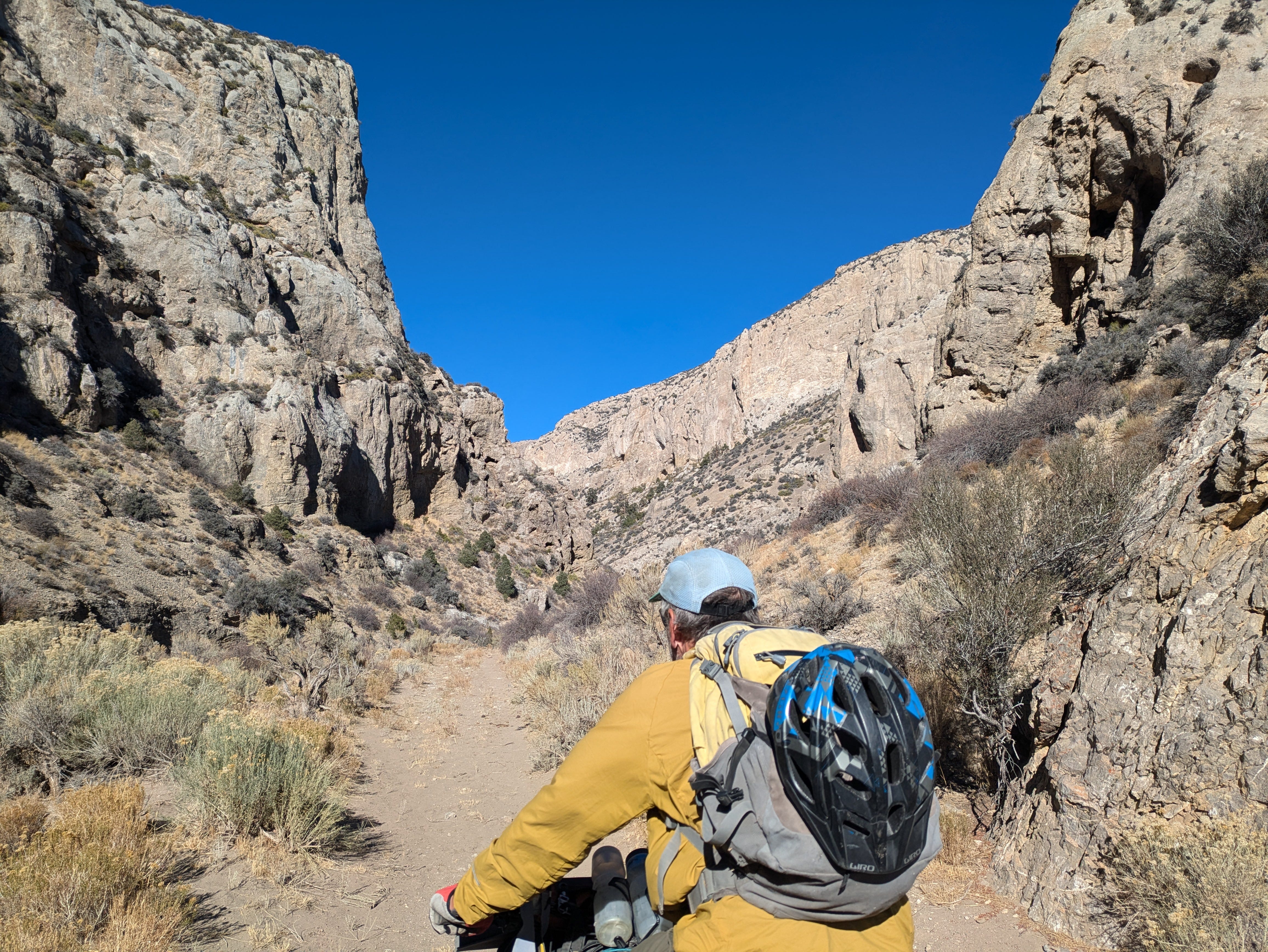
The first place I actively looked for petroglyphs was above Eagle Canyon Park in Sparks, NV. This area in the Pah Rah Range is known to have petroglyphs. Large pillars of basaltic rock created shelter from the wind at a high point where deer might travel through. But I never found the petroglyphs. Much later we did an bikepacking overnight to the petroglyphs, guided by a local who knew where they were. How is it you get a feeling for a place, this place is special.
Wilson Wewa ended his book, Legends of the Northern Paiute with a chapter on “Coyote Writing” and “Spiritual Writing” in Paiute Country. It is a great explanation of value and significance of the petroglyphs and pictographs that he visited with his grandparents growing-up and traveling through Paiute Country. Coyote writing, etsatubono, is just the idea that these images were created by the people who came before the Paiute, by the first creation. Wewa goes on to say that a time will come for the rocks to speak to us again through these writings to prepare us for the future. If you are going to spend time with Coyote writing I highly recommend reading Wewa’s Legends of the Northern Paiute.
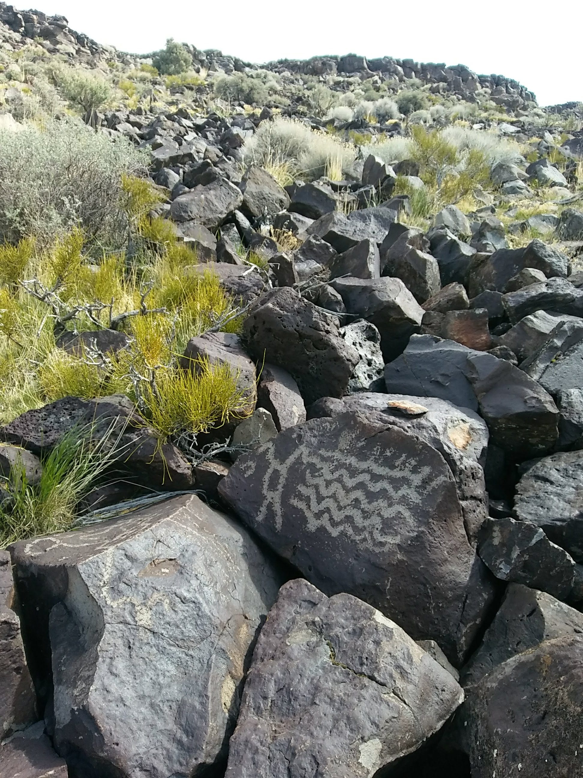
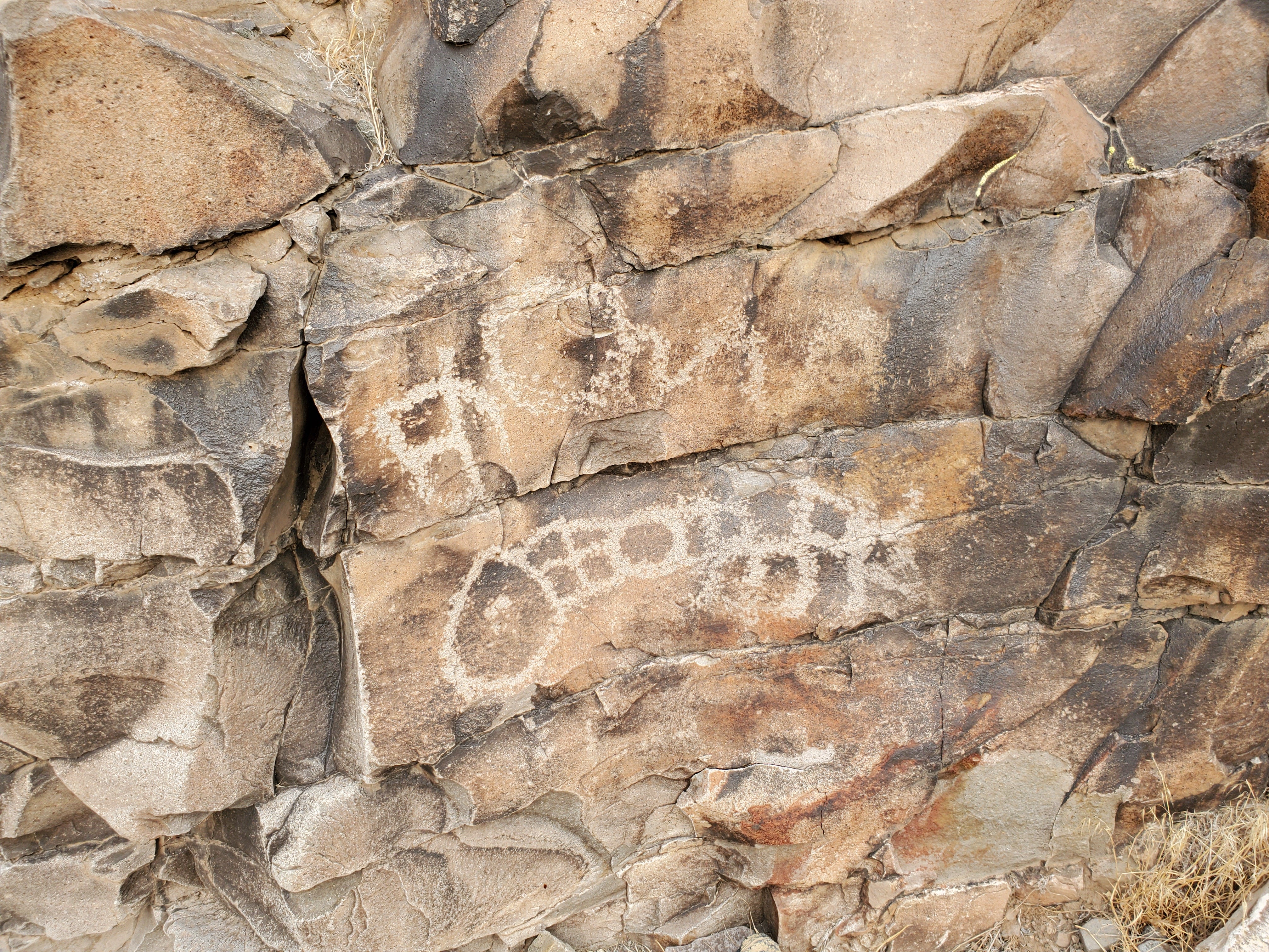
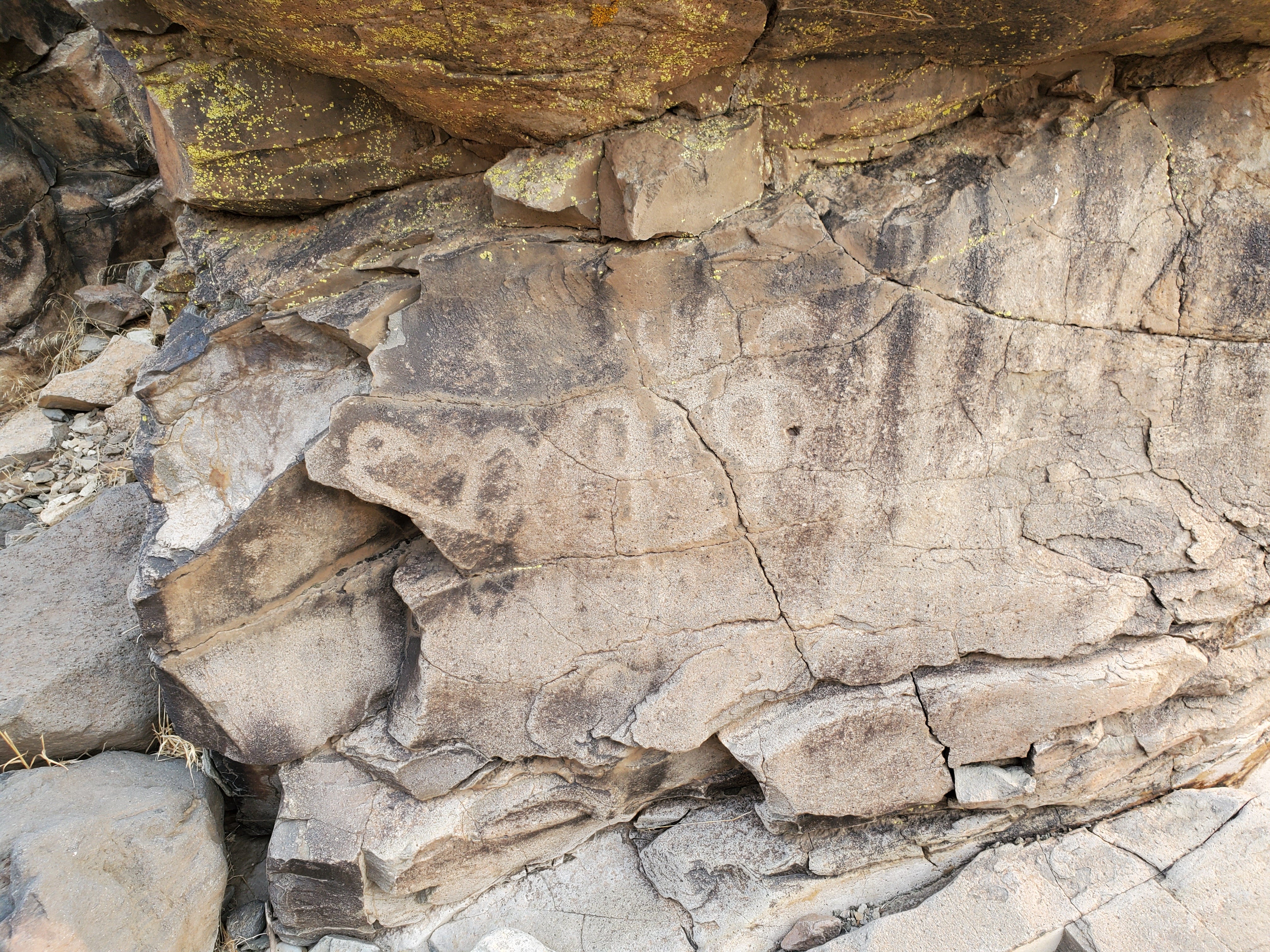
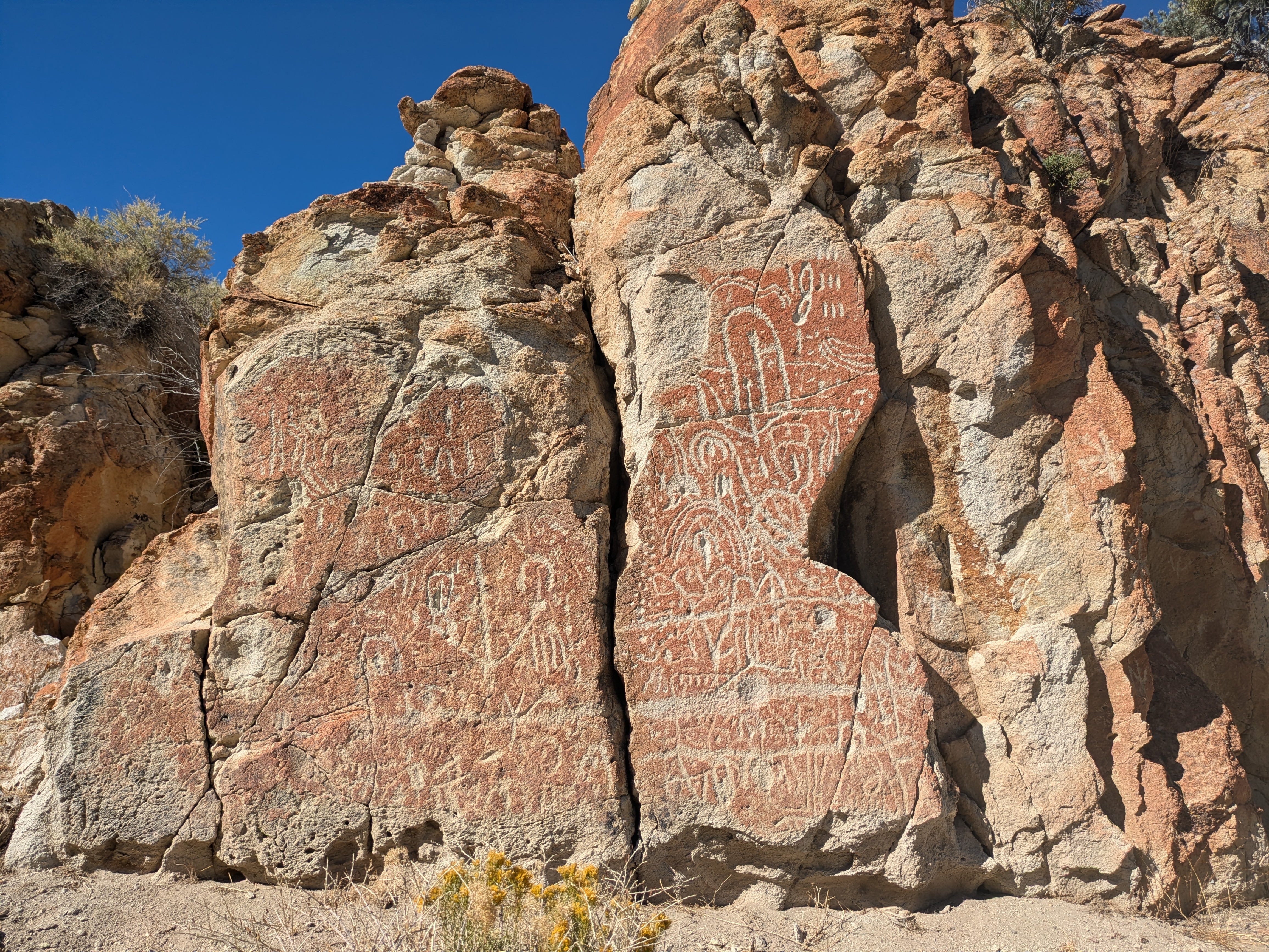
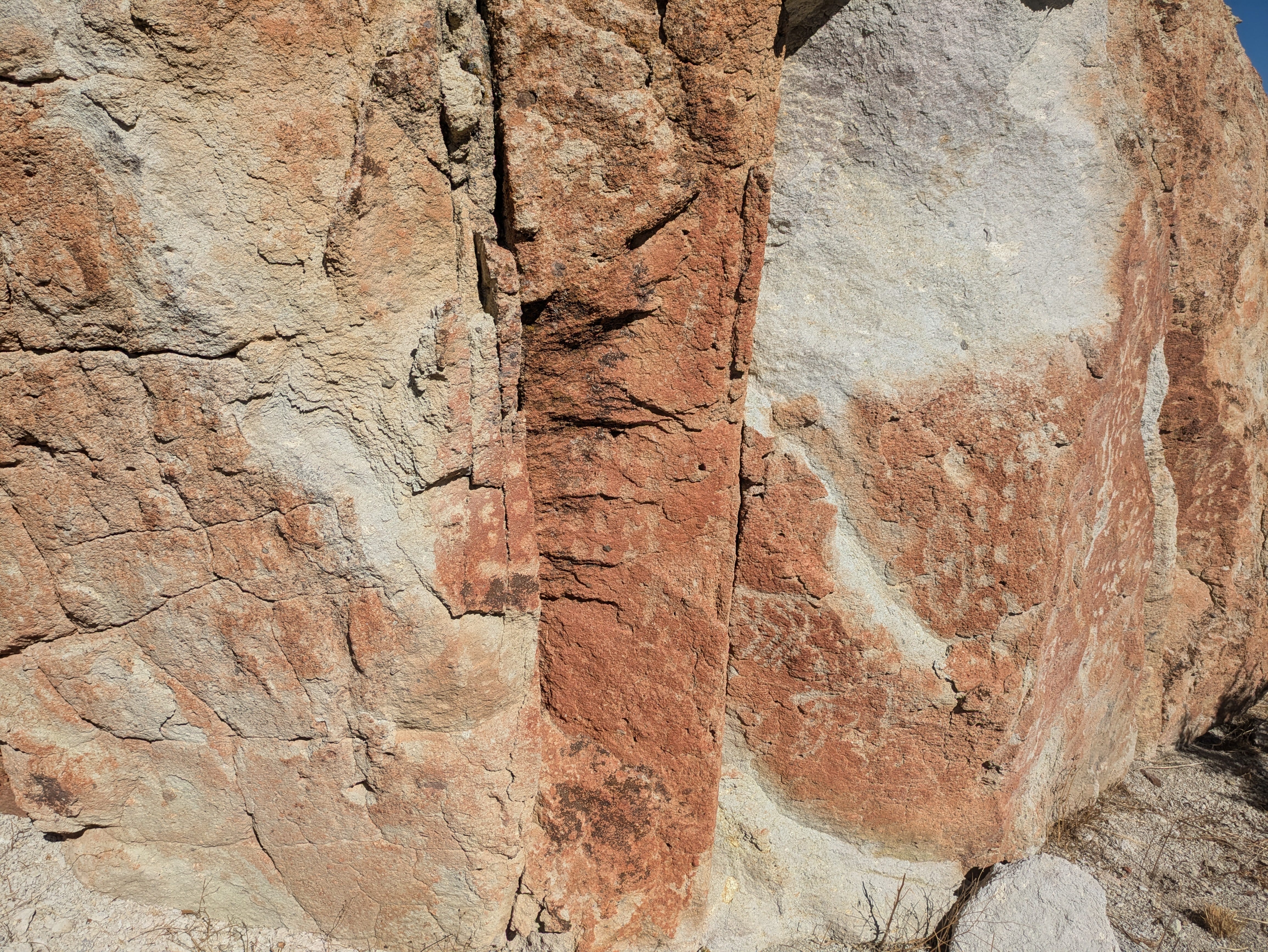
The first major site I visited were the Largomarsino Petroglyphs between Virginia City Highlands and Lockwood, Nevada, in the Virginia Range. This area is famous for the sheer number and variety of petroglyphs. It is a beautiful adventure getting there no matter which route, or method you take to get there.
These prehistoric rock pictures provide a perfect mystery. They represent a culture long gone with only speculation to any meaning. Which begs, what is it that makes us look for meaning? Then once we are given an explanation, our future encounters are explained by this expert view.
This summer I read Great Basin Rock Art, Archaeological Perspectives Angus R Quinlan, Ed. (2007). This is an academic text of 12 scholarly essays but curated in such a way, by Quinlan the executive director of the Nevada Rock Art Foundation, that places symbolic culture within ethnographic and past and present social contexts. What first struck me was recognizing some of the places used as study sites. Then the idea of explaining rock art's meaning as a part of magic and hunting was the only perspective I knew. But the essays provided an alternative perspective: a gender-inclusive view of rock art in the Northern Great Basin.
The androcentric bias in interpretation as well as biases in archaeological methods has clearly overwhelmed popular as well as professional beliefs behind rock art explanations. Shamanism and hunting magic are the two outstanding interpretations in rock art. While contextual clues are used, systematically lithic scatter and projectile points, are preferentially used as evidence of a male dominated, hunting centric areas of activity while rock rings and grinding stones, indicative of domestic female dominated activities, are ignored or not strictly included in analysis. Great Basin Rock Art includes several essays on this notion. This opens the possibility of rock artists being women, in some cases women shamans, and the topics of rock art to be more domestic.
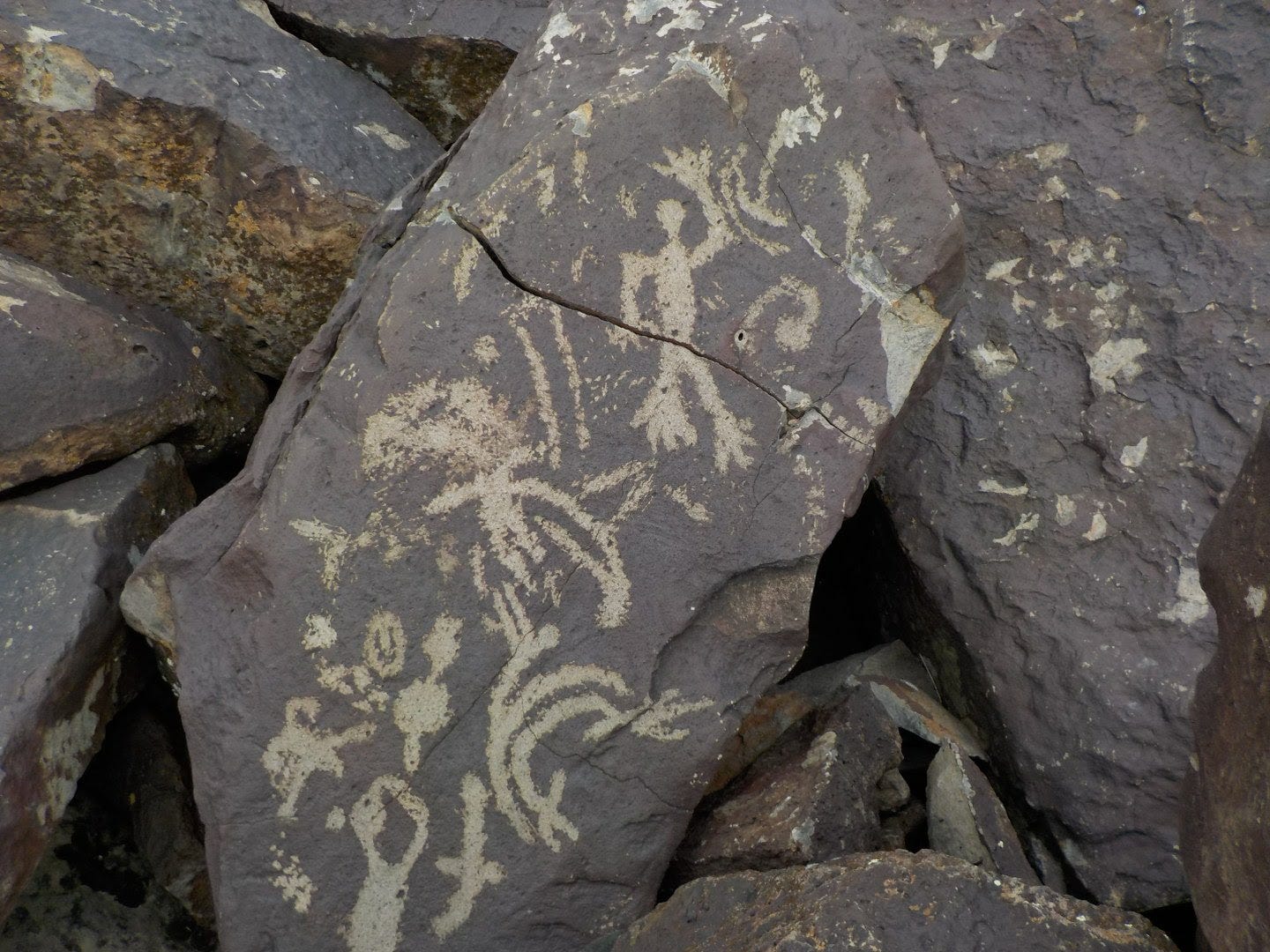
“What does it mean? How old is it?” are the two most popular questions. I also ask, have I seen this before? I came across “unexpected” petroglyphs in Dry Valley north of Pyramid Lake. I was scouting out a route I wanted to share and there was a point on the map labeled, “Ruins” at the bottom of Parker Canyon. I was expecting a homestead or maybe a mine or mill foundation. There was a shallow canyon that had some sort of concrete spillway built but there on the canyon walls were some faint petroglyphs. I photographed them and of course figured this canyon provided shelter from the wind as well as a view of the valley below where deer or antelope (or rabbits) might pass for hunters of long ago. These petroglyphs would have been submerged when Lake Lahontan was at its maximum depth.
More recently I visited Petroglyph Butte in the Hot Creek Range and was drawn to the repeated repeated array of 4X4 dots. My mind immediately went to counting, or a calendar, or a landmark, or the sky. Even more curiously I wondered why I considered those things. Where do my biases come from? Have I seen this before? Sometimes I think to Australian Aboriginal art. It is just where my mind wanders. What is Coyote saying?
Thank you for supporting my storytelling. I hope you find inspiration in these rocks’ stories of the land.
Resources for inspiration and visiting petroglyphs in the Great Basin:
Great Basin Rock Art: Archaeological Perspectives, Angus R Quinlan (Ed.) 2007, Univ. Nevada Press
Legends of the Northern Paiute, as told by Wilson Wewa, James A Gardner (Ed.) 2017, Oregon State Univ. Press
Nevada Adventure Map, David Toll and Paul V Cirac, 2016, Leviathan Media Group - Toll reminds us 200 years ago all of Nevada was Indian Territory. Also check out his, The Complete Nevada Traveler - “The Affectionate and Intimately Detailed Guidebook to the Most Interesting State in America.”
Bradshaw Foundation in collaboration with Nevada Rock Art Foundation work to support the on-going research of Nevada’s oldest cultural sites.
Nevada’s Indian Territory - supports changing the World through eco-cultural tourism for the five major tribes of Nevada, the Washoe People, the Northern Paiute People, the Southern Paiute People, the Western Shoshone People, and the Fort Mojave People. Partnering with Travel Nevada and NativeAmerica.Travel
From Travel Nevada: Hidden Cave and Grimes Point, Gold Butte National Monument, Mt Irish Wilderness Area, Toquima Cave, and for fun - Myth vs. Fact.
From the Bureau of Land Management: White River Narrows, Mt Irish, and Basin and Range National Monument.
From O.N.E. -Online Nevada Encyclopedia, a publication of Nevada Humanities: Rock Art of Nevada and Anasazi Rock Art
October in Review, things I saw from the saddle
I was on the road (backroads) for most of October. I participated in the Volunteers/Members Appreciation campout with Wildwood Open Lands Foundation (WOLF) at the Elbow, Walker River State Recreation Area, Nevada State Parks. Then I we to the Black Rock Desert, High Rock Canyon, Emigrant Trails National Conservation Area to lead the “Crown Jewel” Rides with Friends for 2024. I was joined by Corby C for a tour of the potholes in Fly Canyon, then a wild ride through High Rock Canyon for an overnight. On the way out we joined the Friends of Black Rock High Rock for a stewardship clean-up of the Little High Rock Hilton. At first the area looked pretty clean, but I knew it was a popular attraction and a high impact spot. Then we started trash pick-up. Then raking and using the magnetic rake. After a couple of hours it was remarkable what 5 people could clean-up. Huge thanks to FBRHR’s dedicated staff and stewardship volunteers.
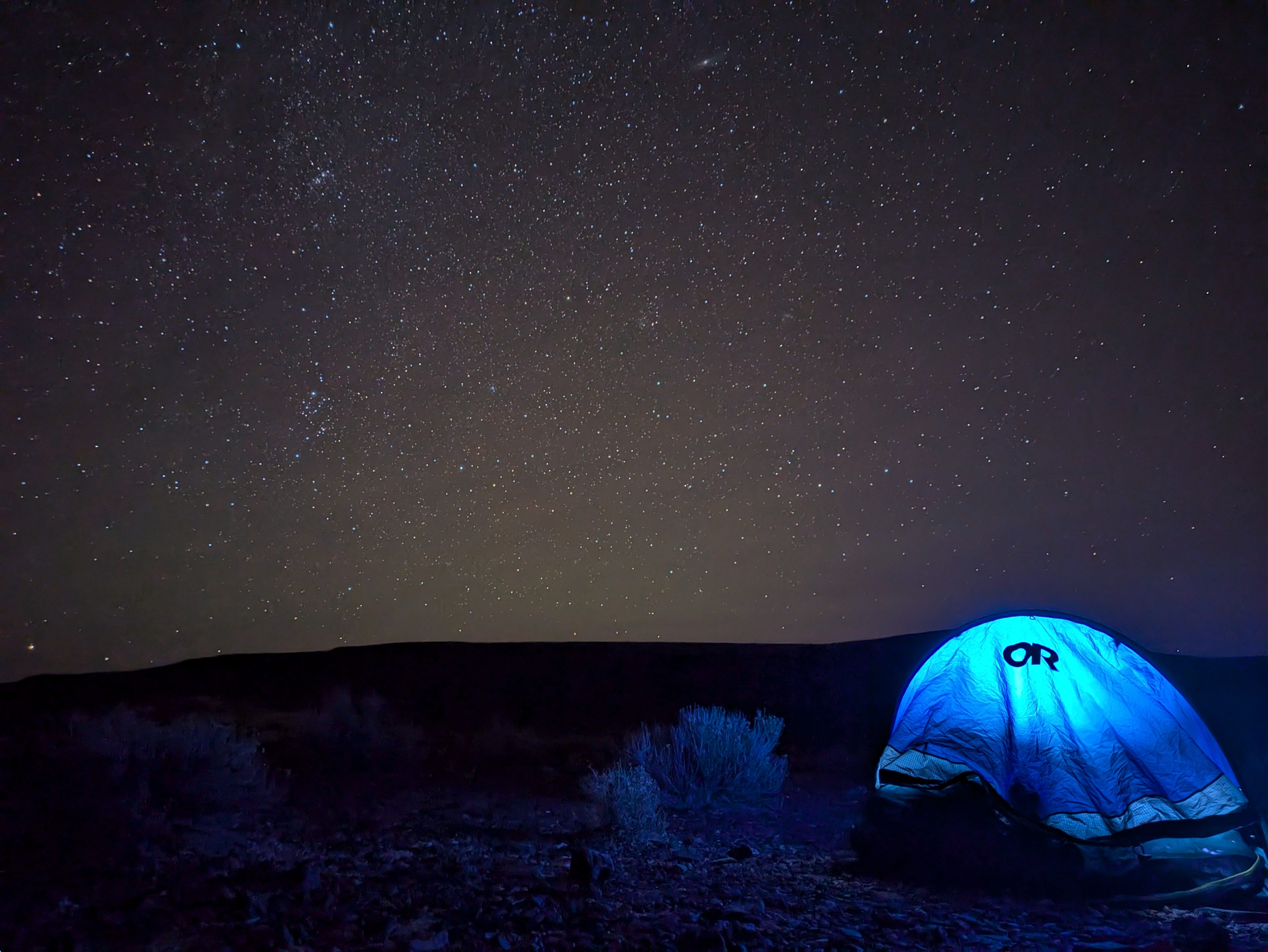
Then I was off to Eureka, NV for the start of Dark Sky’s Route! The route, as drawn covers 620 miles of Nevada backroads inspired by the Comstock Route and mining history, stagecoach stops, and geologic wonders along the way. This was Doug A’s route. I had ridden bits of it on past tours. There have been some highlights on Instagram from Doug A (@seeker57) and I (@bikepackingnv). We cut the route short by 60 miles to avoid a storm, but otherwise everything went swimmingly. No mechanicals, no health issues, no drama, ha! But we were on the road for 15 days, most days were 8 hours of touring, with one complete rest day (day 10) in Ely. We will have a full write-up on our blogs. Our next BIG project is combining this route, the Sagebrush Ripple, and the Middle Gate - Berlin-Ichthyosaur routes into one - The Dark Sky’s Ripple. It will be a 950+ mile trip through central Nevada with surprises at every turn!
While we were out my interview with Reet Singh of Trip Outside came out on their podcasts. I couldn’t be more pleased with how it turned out!
I was back in time for a Nevada Day campout at the north end, Pitch Fork Ranch, portion of Walker River State Recreation Area, Nevada State Parks.
Looking forward to November - January
It is always a balance this time of year between holidays, weather and getting out. Doug A has invited me on a bikerafting trip down to Lake Mead. There are a handful of 1,2, and 3 day trips that I want to do.
As my newsletter topics grow I am tempted to start sharing things/thoughts/reads on those topics in the note/chat/thread portions of Substack.
As always, if there is anything I can do to help get you out there, please reach out!
Good words, I’d like to explore that area as well by bike and see the petroglyphs. Funny, my cat, coyote died this morning she’s named after a coyote the trickster in native American legend. Thanks for sharing this put a smile on my face.